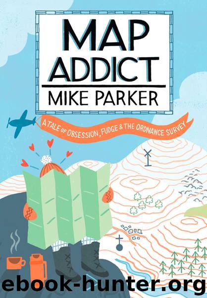
Map Addict by Mike Parker

Author:Mike Parker [Parker, Mike]
Language: eng
Format: epub
Tags: NonFiction
Publisher: HarperCollins Publishers
Published: 2017-05-29T16:00:00+00:00
The controversial Absolut vodka ad, showing Mexico in its pre-1848 borders
5. THE POWER MAP
So Geographers, in Afric-maps,
With savage-pictures fill their gaps;
And o’er unhabitable downs
Place elephants for want of towns.
˜ Jonathan Swift, A Rhapsody
For a taste of the visceral power of maps, you can do no better than visiting two sites in Italy: the Galleria delle Carte (Gallery of Maps) in the Vatican and the Sala delle Mappe (Map Room) in the Doge’s Palace, Venice. The Vatican gallery is a long corridor decorated with forty-four monumental sixteenth-century maps of Italian regions and cities, together with other Church holdings. Its intent is clear: a bold, brilliant use of space and decor to induce a feeling in the viewer of overwhelming intimidation by the sheer power of the papacy. The Venetian map room has an even more explicitly political edge. Its eighteenth-century maps, copies of ones lost earlier in a fire, are sumptuous in their execution, detailing all the known lands of the world, with particular emphasis on Venetian domains and those visited by Venetian explorers, most notably Marco Polo. Visiting dignitaries to the secretive headquarters of the all-powerful, paranoid Venetian republic would have passed through the Sala delle Mappe on their way to see the Doge, having already been dazzled and humbled in equal measure by the Scala d’Oro (Golden Staircase) and numerous other rooms and corridors of unprecedented ostentation. As political strategy, it was meticulously calculated and stunningly effective.
If history is written by the winners, then it’s they that get to draw the maps too, often in the immediate aftermath of victory. Maps have been used for political and propaganda purposes since they were first drawn in the sand with a stick, and have facilitated every war in history. Great leaps forward in cartography have almost always had a military catalyst, not least in our own Ordnance Survey, whose name is a blast from the fledgling days of the Empire, when the Board of Ordnance surveyed and mapped the south-eastern coasts of Britain in case of an invasion by Napoleon.
We like to think that maps are factual and somehow true, that they have little or no agenda, but that can never be the case. Their representation of reality can only ever be selective and subjective. Every cartographer has to decide what to include on their map and, perhaps more importantly, what to exclude. Emphasis of one feature over another requires choice and thus bias, and absolutely no map is too trivial or inconsequential not to upset or offend somebody. When, in 2005, the BBC changed its weather map, a very British storm-in-a-teacup ensued. Gone was the two-dimensional flat elevation of the British Isles, to be replaced by a tilted view taken from somewhere above France. The effect was to emphasise the southern and eastern parts of the country, with a much-reduced Scotland receding into the distance. Within days, the BBC had received over four thousand complaints and questions were being tabled in both the Edinburgh and Westminster parliaments. Faced with such
Download
This site does not store any files on its server. We only index and link to content provided by other sites. Please contact the content providers to delete copyright contents if any and email us, we'll remove relevant links or contents immediately.
How to Read Water: Clues and Patterns from Puddles to the Sea (Natural Navigation) by Tristan Gooley(2885)
Full Circle by Michael Palin(2785)
Into Thin Air by Jon Krakauer(2713)
How to Read Nature by Tristan Gooley(2671)
The Lost Art of Reading Nature's Signs by Tristan Gooley(2289)
In Patagonia by Bruce Chatwin(2280)
Don't Sleep, There Are Snakes by Daniel L. Everett(2222)
City of Djinns: a year in Delhi by William Dalrymple(2140)
L'Appart by David Lebovitz(2124)
The Songlines by Bruce Chatwin(2118)
Venice by Jan Morris(2057)
The Big Twitch by Sean Dooley(2048)
A Thousand Splendid Suns by Khaled Hosseini(2011)
Tokyo Geek's Guide: Manga, Anime, Gaming, Cosplay, Toys, Idols & More - The Ultimate Guide to Japan's Otaku Culture by Simone Gianni(1953)
A TIME OF GIFTS by Patrick Leigh Fermor(1853)
Come, Tell Me How You Live by Mallowan Agatha Christie(1774)
The Queen of Nothing by Holly Black(1768)
INTO THE WILD by Jon Krakauer(1732)
Iranian Rappers And Persian Porn by Maslin Jamie(1715)
